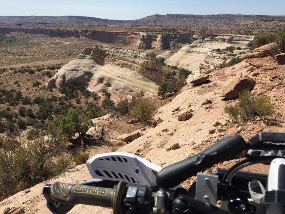
I’ve been hearing fun things about the Western Rim Trail in Utah so I went and rode it
Delightful ViewsI think I see Radiator Springs!Made it!
After I finished it I discovered I rode it in the hard direction. It’s easy if you start on the south west end and ride it toward Rabbit Valley. All the steep loose hills are descents instead of climbs. This would be more fun on a bike, and a lot more fun on an ebike. Now you know
The temperature climbed back up in the 100’s so I took a drive to the high country. I took the frost-heave highway (US 50) to Delta then 92 toward Hotchkis, Crawford, Paonia, Somerset, Redstone, and back thru Glenwood and I-70 west
Sleepy Main Street in Crawford
Crawford was still asleep when I got there. It looks like a nice little town right at the edge of where the desert turns to green forest. Further south it looked like a delightful forest road with hay fields dotting the landscape. I went north via the Crawford Rd to Paonia. The road to Paonia drops out of the green and into the brown/ grey desert. It looks like it has never rained out there. Ever
Town Hall
Paonia was also a bit sleepy-faced. The grocery store is a decent size, but there is no sign out front saying “Grocery Store”. They also don’t do face coverings in Paonia (Written Sept 2020 – pandemic days). Real estate is spendy and there seemed to be a few rich-folk about
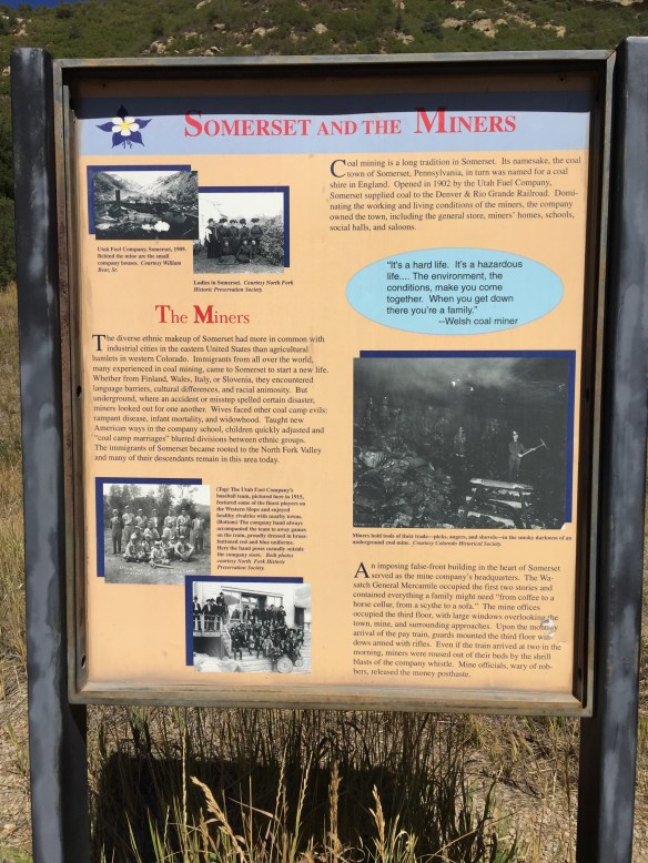
All about local coal
I took hwy 133 over McClure Pass and traveled thru Somerset along the way. Coal mining town gone bust from the look of it. The further I went toward Carbondale the more I saw expensive new SUV’s flying down the pavement. Ah, the smell of money in the fall, mmmmm
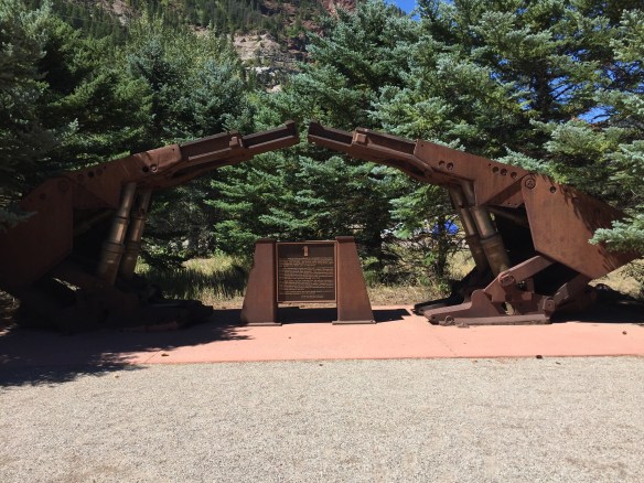
Monument to the miners
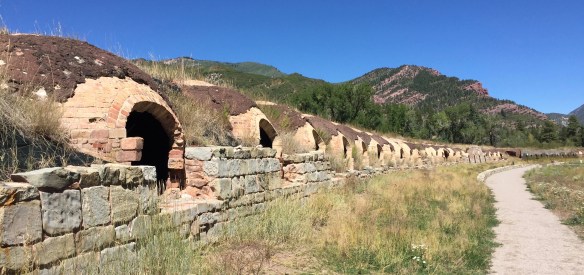
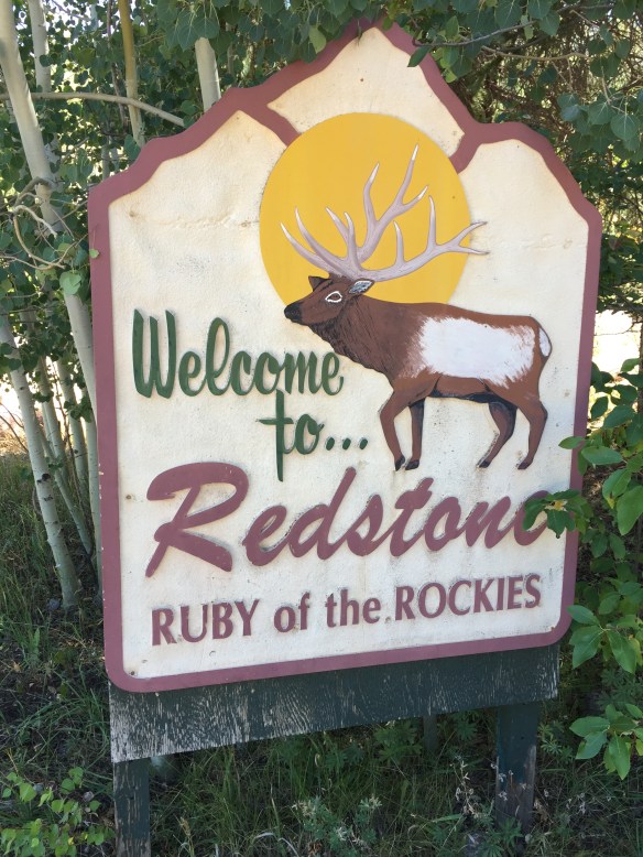
At the bottom of the pass sits Redstone. It was a company town for the coke ovens (the meth labs were in Marble on the Crystal River, hence crystal-meth). Seems coke was a thing besides a drink and a drug
Got coke?Restored ovensBelow is a section of the tale of the coke business in Redstone
“These ovens comprise part of the Redstone Coke Ovens Historic District, where men at the turn of the century [19th to 20th] “coked” some of the country’s finest metallurgical coal, turning the coal into coke, or pure carbon. Brought by narrow gage railroad from the mines above Redstone at Coalbasin, the coal was loaded into the top of the 249 beehive shaped ovens. Redstone cokers cooked the coal for two days then shipped it to Colorado Fuel and Iron in Pueblo, CO, the biggest steel mill west of the Mississippi. There the Redstone coke, limestone, and iron ore were dumped into blast furnaces to create steel, which made the locomotives, steel rails, and barbed wire that settled the American West.” These coke ovens were used between 1900 and 1909, then again from 1959 to 1961
The current Welcome to Utah sign on old highway 6 & 50
I spent last fall testing out routes between Fruita and Moab and I worked out several of them. Some are dirt-bike friendly. Others are big twin-friendly. Yesterday the temperature dropped from the 100’s down to the low 80’s so Zoom! off I went on the Huskie Adventure-450
All that’s left of the Colorado/ Utah Border Monument is the base plate
I rode old highway 6 & 50 from Fruita out to Sulfur, UT then jumped on a dirt road which turned into a gas-line road and took that to the Cisco / Agate road. South to Agate past the dead cow then west to the Cisco Pump House Road on the Kokopelli. From there south to the Kokopelli trail, west to the first fork (turn right) and over the easy-way to UT 128 (easy on a dirt-bike – not for big twins)
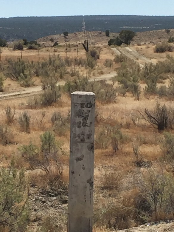
Old concrete mile post on the CO UT border. Notice how the fence, the cut in the trees all the way to the horizon, and the mile post all line up
Down 128 a mile or two then west again on the Kokopelli Trail / Owl Creek Road to Dewey Bridge. It was getting late and the Huskie Adventure-450 was low on fuel (I didn’t fill up before leaving Fruita) so I rode the wyndy blacktop to Moab, gassed up and rode UT 128 to Danish Flat and hopped on the super-slab east to Mack then 6 & 50 to the house. 189 miles round trip, 6.5 hours