Alta Wy to Fruita CO

DSC_0894

View from our Teton Base Camp

Alta to Cokeville WY

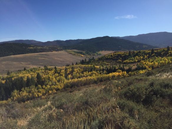
First of three days on the road getting from the Tetons to the western slope of Colorado. We have a camp host gig in Fruita set up for October and November (stop by if you are in the area!). I choose the western route out of Driggs instead of climbing over Teton Pass to Jackson. I added a few miles but it saved me the agony of creeping down the east-side of the pass. The Snake River valley is still in peak colors too so that turned out to be a colorful choice. Yellows, reds, greens, orange – delightful!

IMG_2090

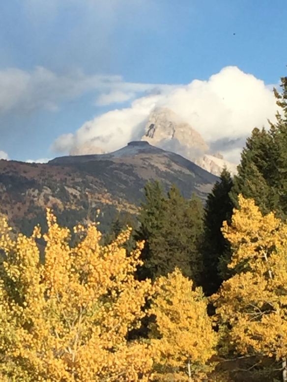
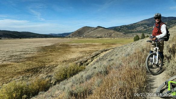
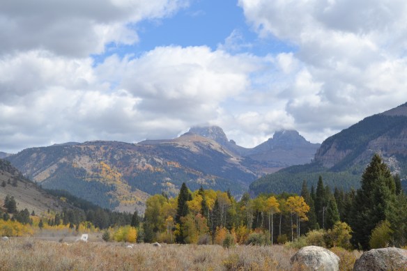
Last day in the Teton’s

The land between Driggs and Cokeville is wonderful valley-bottom surrounded by mountains. I can see buying a retirement villa there and whiling away my golden years watching cows, antelopes, and sunsets.

IMG_2091

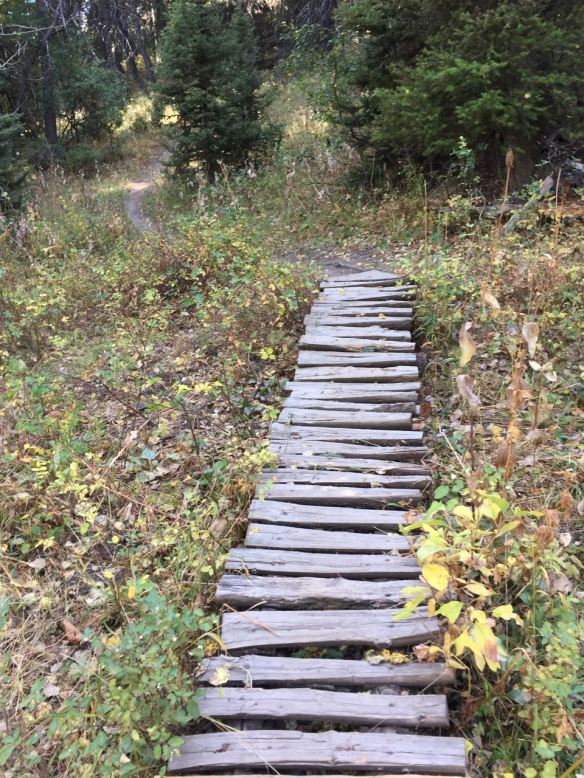
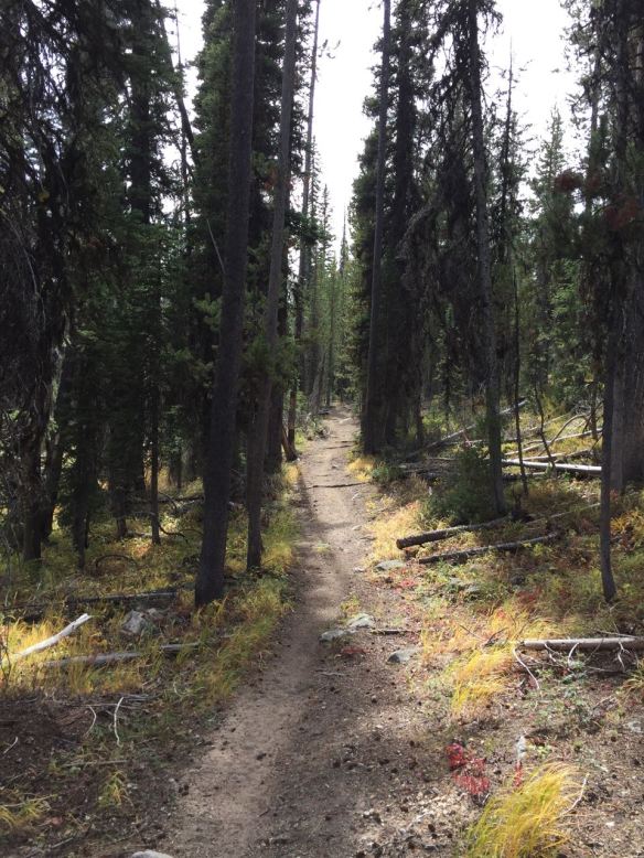
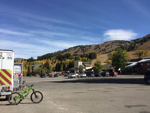
Trail at Grand Targhee Resort

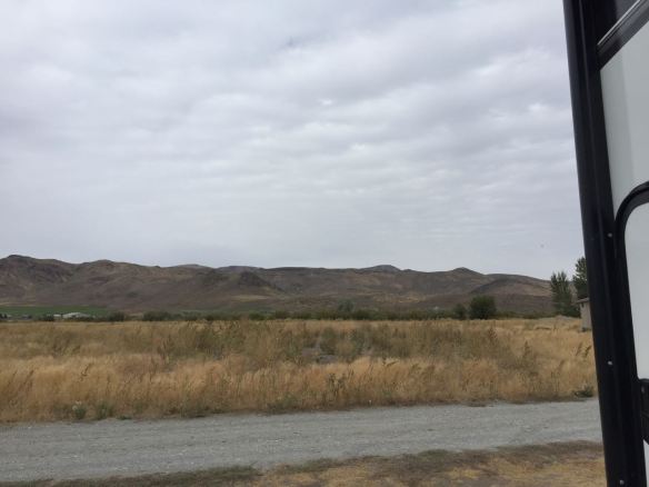
Cokeville to Somewhere south of Flaming Gorge
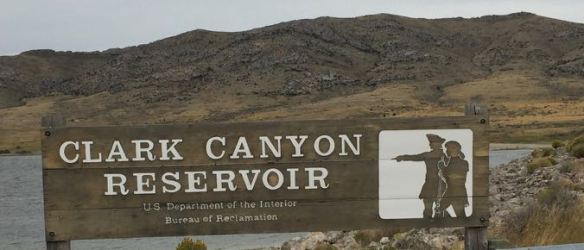
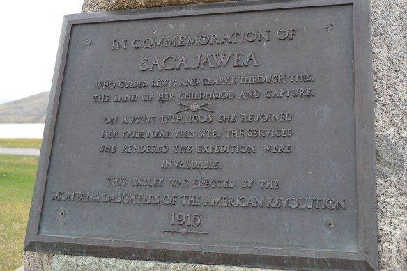
Well I have a new entry into my worst roads in america section. I thought WY 412 was rough until I came upon WY 414 from Mtn View to the Utah state line. Top speed on WY 414 was 45 MPH then I transitioned to UT 43 and it was like driving into the perfect shit-storm of potholes, frost-heaves, and cracks! I had to slow to 30 MPH to keep from bouncing off the blacktop. I’m not sure what the other roads to Flaming Gorge are like, but I advise taking a different route than I did. What a mess! (Hey, Utah DOT. Crack-sealing a shit-storm does not fix it. It just makes a crack-sealed shit-storm).

On the plus-side the colors along the Henry’s Fork River are peaking this week. I even saw a purple bush. And at 30 MPH I had plenty of time to tree watch. I could even read the historical markers without stopping.

IMG_2093

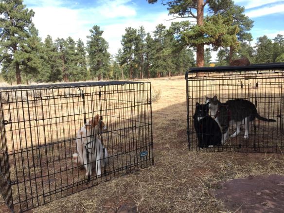
The boys are out for the evening. Please leave a message

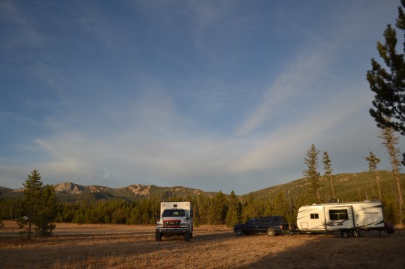
UT 44 south out of Manila is in slightly better shape and winds its way through the side canyons near Flaming Gorge. Up hill and down with some of the slopes at 8% it’s a slow trek. The leaves are a few weeks past peak at this elevation and the grass has long been dormant. We found a camp spot in the forest before the afternoon wind kicked up to the predicted 25-mph gusts.

Why is the word for wind and the word for wind the same? The wind is blowing whilst I wind my way through the forest (winding my watch as I go). English is weird. Lets agree that from now on wind will be the thing that blows and wynd will be what roads do as they twist and turn through the mountains. Good. Proceed.

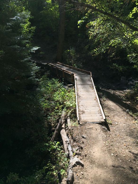
The Forest near Flaming Gorge to Fruita, CO
Tumble dry: Low heat
Wow! Colorado 139 from Rangley to the south side of Douglas Pass is rough, wyndi and steep!! It took 2 hours to drive 35 miles. The aspens on the north side of the pass were in full color: green, red, orange, yellow which made the climb nice. Down the south side of the pass took a very long time. The speed limit is 20 and the corners are 15 MPH. It was nice that we had a 25 MPH headwind holding us back on the descent.

If you want to have some idea what it’s like to pull a trailer on a rough wyndi road whilst the wind is blowing 25 MPH go to the Laundromat, put $50 worth of quarters in the biggest dryer there, get in, select tumble dry, and stay there until the $50 runs out. That’s been my life the past two days.


Let’s Ride!

IMG_2089

Mtn Biking near Driggs ID
Tom and I drove over to the horseshoe riding area west of Driggs and had a great time! The single-track trails don’t get a lot of use which I think is weird because they are wonderful! The area is a mix of open riding past sagebrush and winding trails cutting through dark pine forest, then aspens, and willows. The fall colors were just a little past peak when we were there the last week of September.

IMG_2087

Hike a day
Tom and I hiked up the Teton canyon trail to the north for about 3.5 miles. Round trip took about 4 hours and boy were my feet sore! The views were delightful and we didn’t get attacked by any moose or bears so that’s a win in my book.

IMG_2085

Mtn Bike Grand Targhee Ski Area
The lifts were all closed so no epic downhill rides for us! In fact most of the area was closed, the stores were closed, and some of the mtn bike signs were already taken down. We rode over in the Perma-grim area and had a great time. Lots of rolling climbs through the aspens and a few ripping descents with high-bank turns.

DSC_0889


.

Stanley ID to Alta WY

IMG_2081
We left the Sawtooth’s on the last warm day of the week and headed toward the Tetons. Winding our way down along the river was delightful. Nice fall scenes most of the way as the valley opened up and the road straightened out. I stopped in Arco to get gas, do some laundry, and surf the ‘net. Back on the road we’re back-tracking our route a bit across the Idaho National Lab area. Lots of sagebrush and wind. Lots of sagebrush and wind.

Stanley to Alta Part II
There was frost on the windscreen overnight. We stopped for the night out on the windy sagebrush plains west of Rexburg ID. Next morning we rolled into town and bought some propane at Alpine Propane. $16 filled a 30 lb tank. From there it was east again to the foot of the Tetons where we scored a nice camp spot on a creek.


Somewhere north of Stanley ID

DSC_0886
Yup. Well below freezing. Camp is north of 44* latitude at about 6600 feet and the temp dropped to 17*F before the sun came up. The furnace ran 20 minutes at a time with a 15 minute break between most of the night. It’s a toasty 65* inside and I have a cat on my lap (prrrrrr). My friend Tom, who camped next to us, does not have a real heater in his camper yet. It’s something he has planned for the future so I’m going to guess that it’s a bit chilly over there this morning. (after I wrote that Tom came over with his breakfast to eat in a warm kitchen)

IMG_2082

In the shadow of the Sawtooth Range
I met my friend Tom and his 85% completed expedition vehicle near Stanley and after I took the 10¢ tour we went for a bike ride on the Fisher Creek Loop trail. The trail is in an area that burned a few years ago. The first part has a climb up a dirt road through the changing colors of fall. Yellow, oranges, and bright greens – delightful! The last half of the trail is single-track through burned areas followed by single-track through a nice pine forest.

IMG_2078

Swamp Creek Ride
Day two Tom and I went up Swamp Creek about 5.5 miles. I think they named it Swamp Creek to keep people from going there. It was a great ride through forest along a creek on single-track the whole way. There were about 17 creek crossings in late Sept so I bet it’s real wet in the spring. We saw paw prints of a mountain lion on the trail. One paw print was placed precisely inside a horse’s hoof print and it filled the hoof print. Big kitty!

IMG_2080

The Mountain Lion foot print is on top of a horse hoof print. The horse shoe print is visible at the top of the pic. And yea, we looked for claw marks and it’s not a dog paw print. We saw a bunch of them!

.

Caldwell to Hot Springs Campground

IMG_2072 (1)
Near Garden Valley ID

We were heading from Caldwell to Stanley, ID and google maps says it’s a 3-hour trip. Google must be a local driving a Subaru Outback because there is no way you can pull a trailer betwixt those places in 3 hours. After 4 hours of driving we pulled into the Hot Springs campground, had dinner, and went for a walk to the hot springs. With at least an hour-and-a-half left to go before we get to Stanley it was a fine place to stop and rest.

IMG_2070

Hot Springs to FR 195
Two more hours to pull a trailer as far as speedy-google-zåles can motor in an hour. We did find a nice wide, flat spot to park the trailer and wait for a friend to catch up to us. The grass has all gone dormant here and the trees are turning yellow at this elevation. Last night the temps dropped into the 30’s and I expect well below freezing tonight.

DSC_0885

.

Caldwell, ID to La Grande, OR

IMG_2073
Home-again for the RV.
I’ve been planning to visit the factory that built my coach since late spring, but the temperatures in eastern Oregon were over 100* most of the summer so I stayed away. Now that fall has arrived and temps are in the 70’s it’s time for a visit.

We arrived in La Grande on a Sunday morning and spent the day riding on the Mount Emily Recreation area. What a wonderful place! I rode Red Apple and MERA loop. About 9 miles of sweet single-track riding. There looks to be plenty of riding on the mountain to keep a rider busy for a month or so. The trails were in great shape too. The single track is still single and there is ample top-soil, very few rocks or roots. Perfect for me!

IMG_2072

Monday morning at about 05:30 workers began arriving at the factory. I know this because we camped in the employee parking lot Sunday night. Around 7:30 I saw Todd, the service person I’ve been talking to for a few months now, at the RV parked in the lot next to us. I introduced myself and he took a look at the reasons I brought the coach to the factory.

A little back-story here before we go on. I’ve been trying to get the dealership Ketelsen Campers in Wheat Ridge CO to fix some warranty issues. Their response has always been “bring it in and leave it for a couple months and we’ll get to it”. That does not work for me since I’m using it all this year. Ketelsen is a Camping World owned company and they have taken on all the worst qualities of their parent. They have also taken to blaming manufacturers for the delays they create. I’m guessing it’s to keep RV buyers from actually getting any warranty work through the dealer. Like cable companies and banks – make it too hard to get anything done and people give up and go away.

Now let us contrast that with the OUTSTANDING service I got from the manufacturer! Todd has always been on top of the situation. When I have questions Todd gets me answers. When I asked him if I could bring the coach by and have him look at my concerns he said yes indeed (and he recommended the Mt Emily riding area – sweet!). The day I arrived it just happened that a customer had canceled their service visit so I got their spot in the schedule. Man! Sometimes I am so lucky it freaks me out a bit!

I gave Todd the coach in the morning and signed up for the factory tour at 10. Kevin took a half-dozen of us on a walking tour of the factory floor and we got to see how the RV’s are built. Very impressive! I have had a few campers and trailers and I figured out how they were built by working on them. This is the first time I’ve seen how they are built from the beginning and Outdoors RV’s are very well made. A lot of the info is in the brochure and on their website so I won’t go over that information here ( ttp://outdoorsrvmfg.com/) .

It was impressive to see how the components like frame, floor, walls and roof are attached to each other and to have Kevin tell us why certain parts are made from different building materials so they can flex without separating (remember it’s a house undergoing an earthquake each time it gets moved). That days tour was about 3 hours because of all the questions we had for Kevin. The tour ended about 1 pm and my coach came out of the shop at about 2:30. Not bad timing.

The afternoon and evening were spend getting back to Caldwell so I could go to some meetings on Tuesday in Boise.


Picabo to Caldwell, ID

IMG_2065
We had a nice down-wind run southwest to Mountain Home then northwest to Caldwell. It is fall on the plains of Idaho and the grass has all gone dormant coloring the landscape tan with spots of sagebrush-green. We are hanging out at David’s dad’s house while we get some chores done in town. After several months in rural america Caldwell seems very busy with people rushing every-which-way!


Clark Canyon to Silver Creek Campground

IMG_2064
Near Picabo ID
The morning started out overcast and cold. The clouds dropped some fresh snow on the mountains near our camp while the wind whipped up some whitecaps on the reservoir. The drive south into Idaho was scenic with leaves changing colors, and mountains on both sides of the interstate. Once out on the plains of Idaho we hung a right and followed the foot of the mountains south and west past farms, the Idaho National Lab, and Craters of the Moon. We stopped for the night at an Idaho Fish & Wildlife camp spot/ river access point at the end of a mile or so of wickedly washboarded roads.

Lewis and Clark Caverns to Clark Canyon Reservoir

IMG_2063

Near Dillon MT and like everything in these parts named for either Lewis or Clark or both. The Bureau of Reclamation built a dam and a campground (a free one at that!) so we stopped for the night and camped near the water. I let the boiz out and they got to have a little romp around camp before the wind kicked up and started rocking the coach.

Near the campground, and likely at the bottom of the lake, is where Sacajawea was reunited with her birth-tribe on the outbound leg of the Corps of Discovery trip.

DSC_0881

IMG_2059

The north wind is cold and reminds me that winter is on its way. The trees are turning yellow and it won’t be long before the white stuff drifts down from the sky.

DSC_0883

I liked the color-contrast


DSC_0879

Clark Canyon Reservoir

.

Tongue River to Lewis and Clark Caverns

IMG_2057
The caverns Lewis and Clark passed by but didn’t find is too long a name for a State Park so there we have it.

The trip from Tongue River to L & C took all day, some of it into a steady head-wind but was otherwise uneventful. The boiz and I caravaned with Jim and David and their doggies. Jim and David caught up with us near Springtime MT then we headed west to the mountains. Once we got off the interstate at Three Forks the two-lane highway wound through some very picturesque valleys along the Jefferson River. The campground at the park is a bit small and tightly wound, but it feels open enough. We though it would be mostly empty two weeks after Labor Day, but we got the last two open spots with power. If we had arrived after 4 the place would have been plumb-full.

Next day we drove the rather steep and narrow road to the cavern’s gift shop and entrance station. The tour we opted for was 2 hours long and had about 600 stairs. $12 got us a front row seat on the walking tour the caverns. We also had to chip in 2 miles of walking, climbing, and stooping.

IMG_2060

Jim, David, Mike

After the tour I took the mountain bike for an hour-long climb up a nearby trail. It took 15 minutes to get back to camp. Silly gravity.

IMG_2061

.