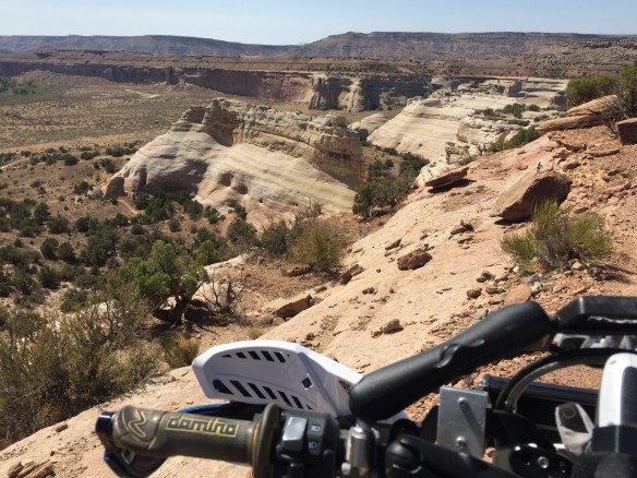
I’ve been hearing fun things about the Western Rim Trail in Utah so I went and rode it
Delightful ViewsI think I see Radiator Springs!Made it!
After I finished it I discovered I rode it in the hard direction. It’s easy if you start on the south west end and ride it toward Rabbit Valley. All the steep loose hills are descents instead of climbs. This would be more fun on a bike, and a lot more fun on an ebike. Now you know
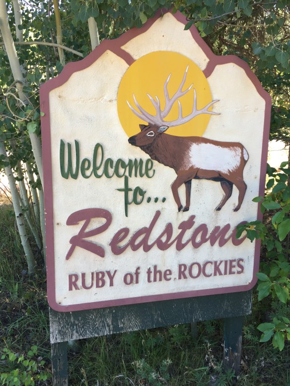
The temperature climbed back up in the 100’s so I took a drive to the high country. I took the frost-heave highway (US 50) to Delta then 92 toward Hotchkis, Crawford, Paonia, Somerset, Redstone, and back thru Glenwood and I-70 west
Sleepy Main Street in Crawford
Crawford was still asleep when I got there. It looks like a nice little town right at the edge of where the desert turns to green forest. Further south it looked like a delightful forest road with hay fields dotting the landscape. I went north via the Crawford Rd to Paonia. The road to Paonia drops out of the green and into the brown/ grey desert. It looks like it has never rained out there. Ever
Town Hall
Paonia was also a bit sleepy-faced. The grocery store is a decent size, but there is no sign out front saying “Grocery Store”. They also don’t do face coverings in Paonia (Written Sept 2020 – pandemic days). Real estate is spendy and there seemed to be a few rich-folk about
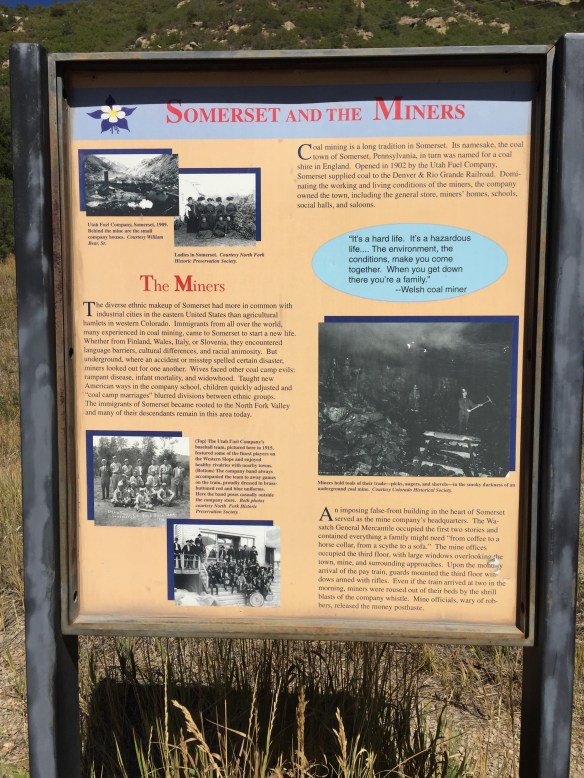
All about local coal
I took hwy 133 over McClure Pass and traveled thru Somerset along the way. Coal mining town gone bust from the look of it. The further I went toward Carbondale the more I saw expensive new SUV’s flying down the pavement. Ah, the smell of money in the fall, mmmmm
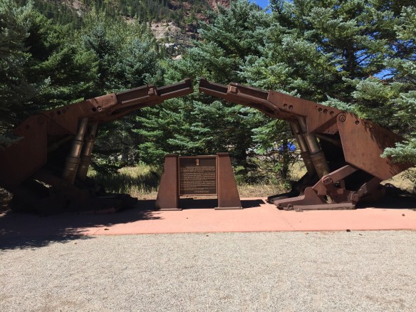
Monument to the miners
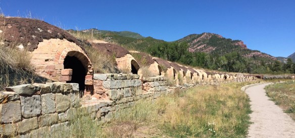
At the bottom of the pass sits Redstone. It was a company town for the coke ovens (the meth labs were in Marble on the Crystal River, hence crystal-meth). Seems coke was a thing besides a drink and a drug
Got coke?Restored ovensBelow is a section of the tale of the coke business in Redstone
“These ovens comprise part of the Redstone Coke Ovens Historic District, where men at the turn of the century [19th to 20th] “coked” some of the country’s finest metallurgical coal, turning the coal into coke, or pure carbon. Brought by narrow gage railroad from the mines above Redstone at Coalbasin, the coal was loaded into the top of the 249 beehive shaped ovens. Redstone cokers cooked the coal for two days then shipped it to Colorado Fuel and Iron in Pueblo, CO, the biggest steel mill west of the Mississippi. There the Redstone coke, limestone, and iron ore were dumped into blast furnaces to create steel, which made the locomotives, steel rails, and barbed wire that settled the American West.” These coke ovens were used between 1900 and 1909, then again from 1959 to 1961
The current Welcome to Utah sign on old highway 6 & 50
I spent last fall testing out routes between Fruita and Moab and I worked out several of them. Some are dirt-bike friendly. Others are big twin-friendly. Yesterday the temperature dropped from the 100’s down to the low 80’s so Zoom! off I went on the Huskie Adventure-450
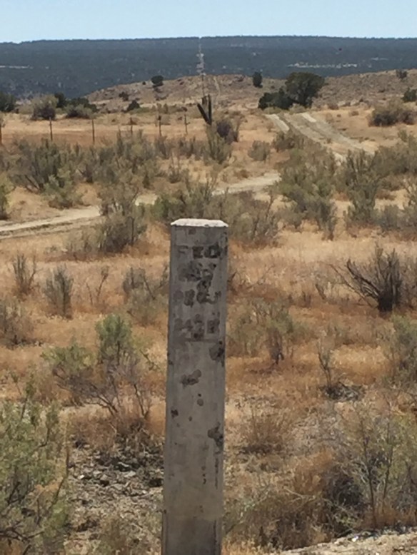
All that’s left of the Colorado/ Utah Border Monument is the base plate
I rode old highway 6 & 50 from Fruita out to Sulfur, UT then jumped on a dirt road which turned into a gas-line road and took that to the Cisco / Agate road. South to Agate past the dead cow then west to the Cisco Pump House Road on the Kokopelli. From there south to the Kokopelli trail, west to the first fork (turn right) and over the easy-way to UT 128 (easy on a dirt-bike – not for big twins)
Old concrete mile post on the CO UT border. Notice how the fence, the cut in the trees all the way to the horizon, and the mile post all line up
Down 128 a mile or two then west again on the Kokopelli Trail / Owl Creek Road to Dewey Bridge. It was getting late and the Huskie Adventure-450 was low on fuel (I didn’t fill up before leaving Fruita) so I rode the wyndy blacktop to Moab, gassed up and rode UT 128 to Danish Flat and hopped on the super-slab east to Mack then 6 & 50 to the house. 189 miles round trip, 6.5 hours
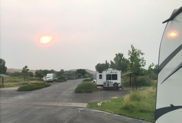
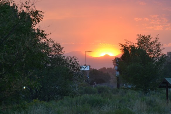
The Sun, half as bright as a car’s turn signal and just as amber-colored, is about an hour and a half from setting. It’s dark enough for automatic headlights to come on
The power of the Sun so muted by the smoke the temperature has dropped from 95* to 85*F in less than an hour
White flakes drift gently down like snow on a windless February day; ash from the Pine Creek fire
So there are a few fires burning in Colorado this week. One is snowing ash on everything in Fruita, and the other has the interstate closed so all my online orders are delayed a few days
Sunrise over the Pine Creek FireNasty ash on everything these daysA red sun
So now we’re wearing an ash mask on top of our Covid mask to stay safe. The good news is we only have to put up with this until the rainy season which maybe starts in October????? So only two months or so away
Since it’s getting into the 100’s in Fruita again I headed up to Grand Mesa for coolness and adventure
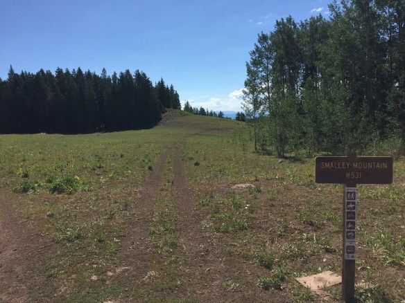
I started here
I started my day in Collbran then went North and East from there
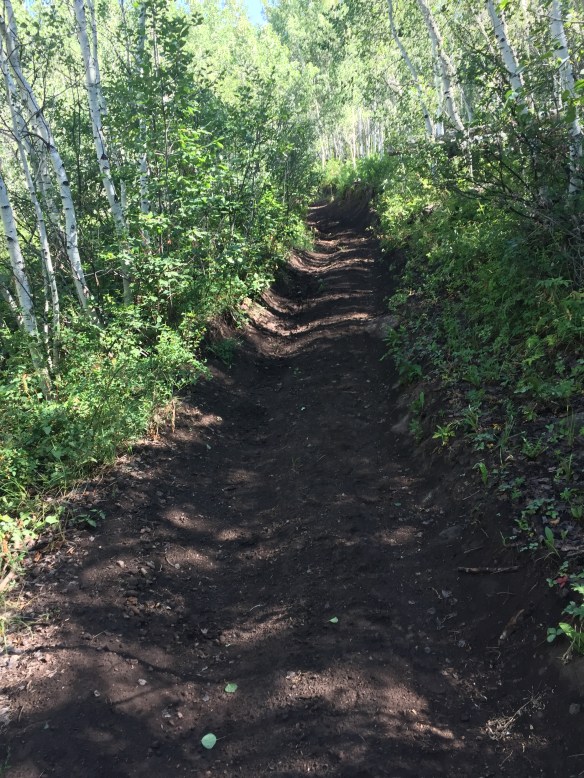
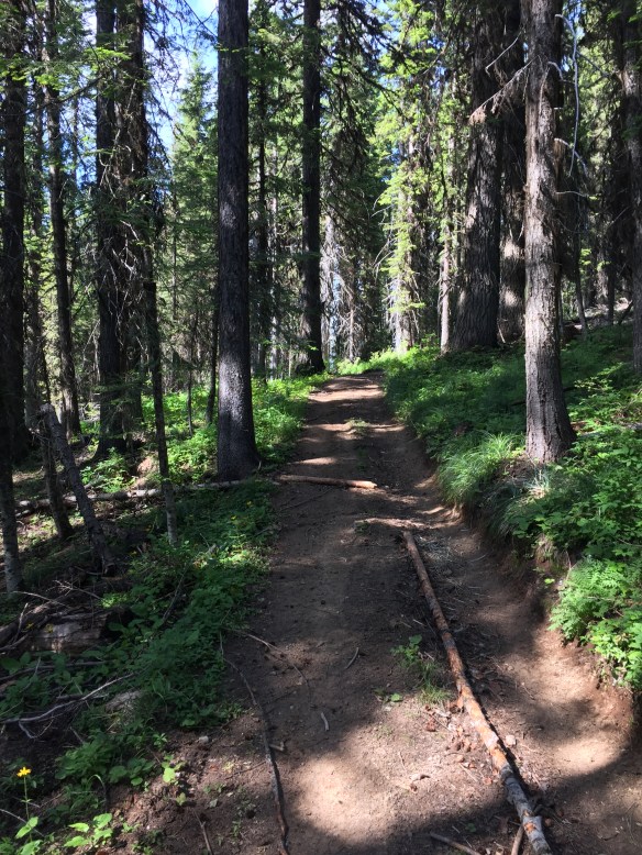
Loamy little two-track thru the woods. Looks more like Idaho than the western desert of Colorado
I rode a loamy little two-track ATV trail up to the boundary between the Grand Mesa and White River forests
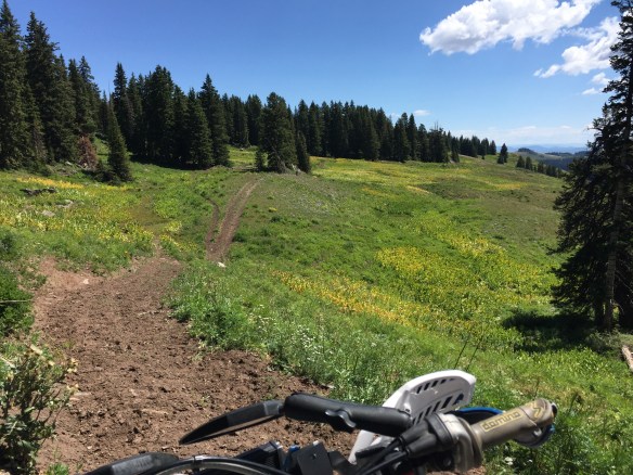
Up on the border-lands. Didn’t have to move the bike to get two pixOn the border-landsAt a cross-roads up on Grand Mesa (I took the road less traveled. It made all the difference)
I didn’t see but one person and a half-dozen cows the whole day. It looked as though the trails had not been used by ATV’s for awhile. Only cow and horse feet prints marked the soft earth
This trail is most used by animals with hooves. Apparently Cows like ATV trails tooNice little pond on the MesaIt might look small, but the top is more than 10,000 feet above sea level
Tennessee-Mike, 3-cat Mike, and Eric went to ride the Idaho BDR. We had some great rides, great meals (thanks Eric) and some cool crisp days:
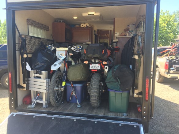
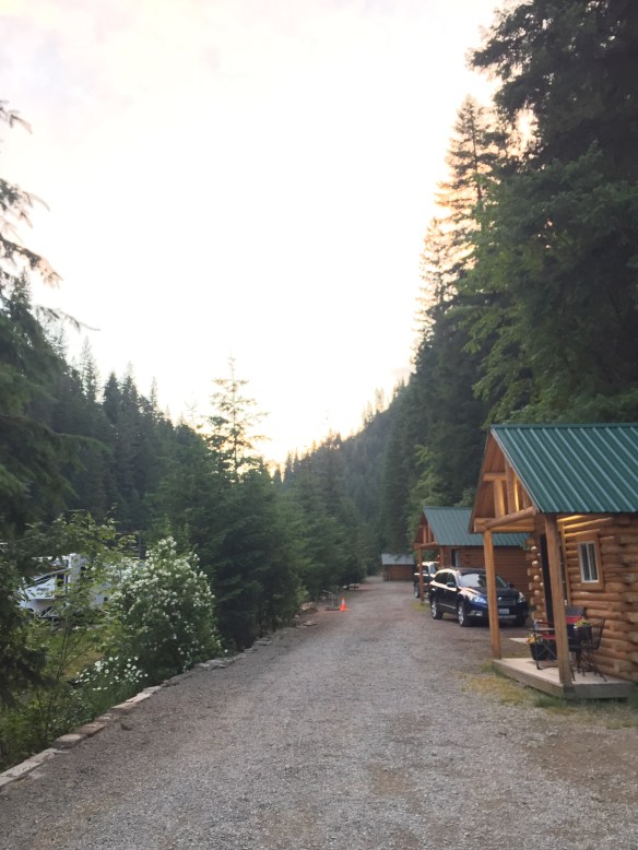
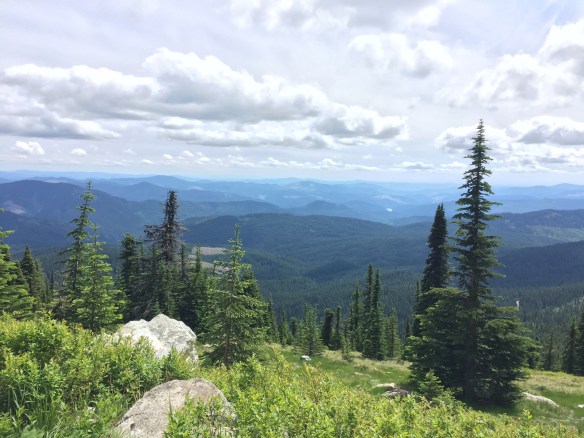
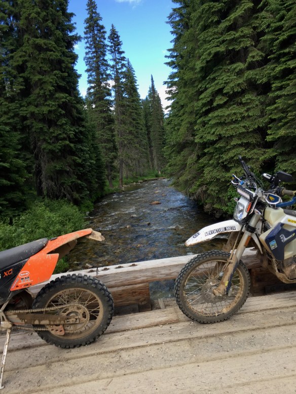
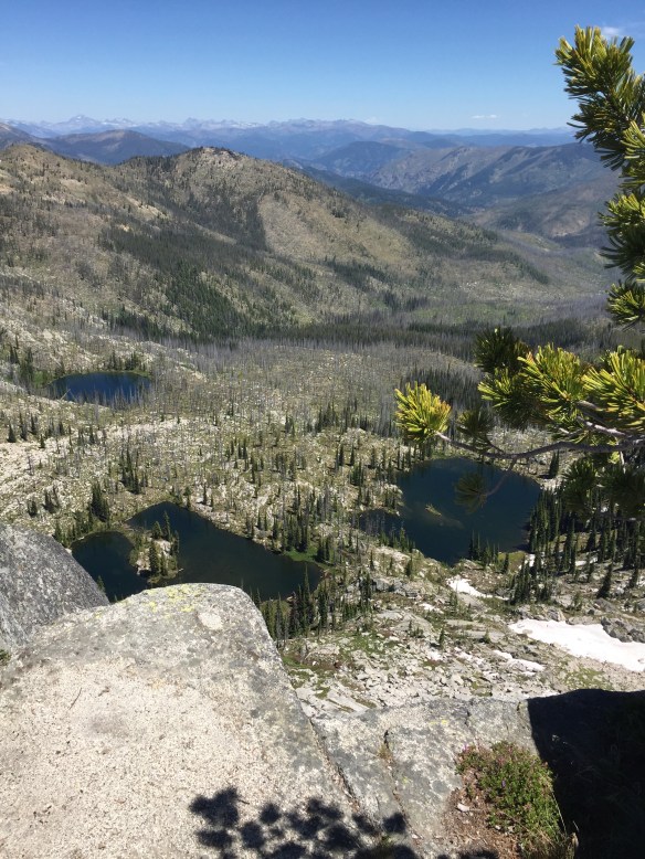
The Toy-Hauler all loaded up!Our first campground in Wallace, IDOn the trail between Avery and Blue CabinThe Blue Cabin on the Idaho BDR routeDown by the riverSo beautiful! And cool too, only about 80* here – over a hundred back homeBlue sky, green trees!Trail marker tree on the Lolo Motorway Wonderful trails and roads in the area around Lolo PassWild Rose! I saw and smelled a lot of these on the tripThis is in the men’s room at the Lolo Hot Spring Campground. It might have been a good idea before the virus of that name swept the nation. Now, not so muchTennessee-Mike using his big-dog skid plate to keep the KTM-790 from leaving the trail. He parked it on a big rock!Burnt Knob fire look out buildingThe view from Burnt Knob toward the NorthLooking down from the tower at Elk Summit (one of about 50 places called Elk Summit in Idaho)Sweet two-track North of Elk City, IDGettin’ lost on the two-track near Elk CityYup, the Fall River road is still washed outOne more watch tower before we head home
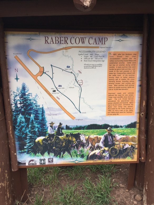
There is an old historic cow camp up on the Mesa which has been preserved for our enjoyment. It was likely tough work in the day, but now we drive to it in air-conditioned rental cars so it’s no big deal
Back in the olden days up on the MesaInside the upper cabin. Fancy!
The inside of the upper cabin is quite nice. It smells a little dusty; nothing some sweeping and new curtains couldn’t fix
Lands-end observatory
Further west on FR 100 I came to Lands-end. It’s where the Mesa turns to a cliff and falls into the Grand Valley. Super great views and decent cell phone service. The local wildlife has figured out that humans are a source of food. They put on quite a show for a meal 🙂 so squee!
These little dudes are abundant at the Lands-end look out pointOne of the many reservoirs up on Grand Mesa
I’m in stand-by mode these next few weeks. I have a big trip planned for mid-july and I don’t have as much time to play in the desert now that it’s HOT. I did manage to sneak in a couple bike rides though. My friend Tom came to town with The Lost Box and we went riding out in the Kokopelli area
My friend Tom stopped by with the Lost Box Expedition truck this week
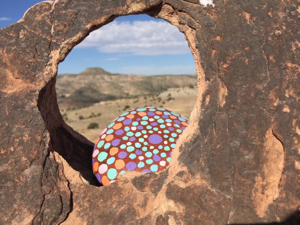
Some creative person left a kewl gift for passers-by out on the Wrangler trail
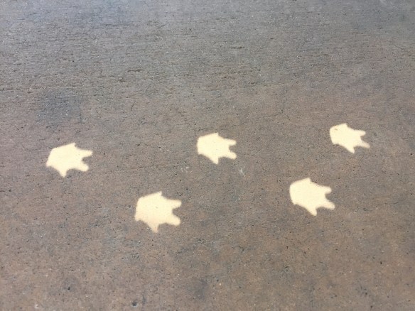
This is so kewl! I saw this on the Wrangler TrailBaby dragon foot-prints!
It seems there is a baby dragon in the Park making cute little foot-prints
First-off a rant aimed at Target! I ordered some corn chips along with other things and the dufus who packed it put the can goods on top of the corn chips. Grrrrrrr
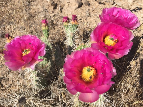
Cactus Blooms!
Meanwhile back at the ranch … CACTUS BLOOMS!!
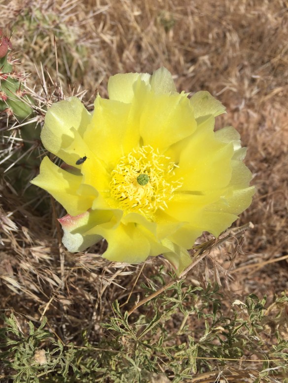
Yellow Cactus!
I love these little flowers so much!
This little delight is about 1.5 cm in diameter
I also took a couple rides out where the peeps don’t go and found myself on the Old Spanish Trail above the Colorado River. I’m a little confused as to why anyone would ride this way to get somewhere, and it’s possible that the somewhere that this trail served has disappeared since then (POOF!) [https://en.wikipedia.org/wiki/Old_Spanish_Trail_(trade_route)]
As advertised
I also took a spin on Lions/ Kokopelli trail since I’ve never been this way before. An early morning delight!
Looking down on Steve’s Loop from Lions/ Kokopelli Trail
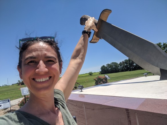
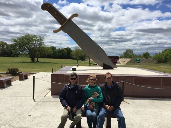
I friend of mine went traveling across Texas and stopped at the world’s Largest Bowie Knife (Bowie, TX). I was there a few years ago so here are pictures!
A friend wielding the world’s largest Bowie Knife!Me, Lana holding Gus, and Mike (it was super-windy that day)