Beacon Station, CA

Beacon Station petrol stop since 1924


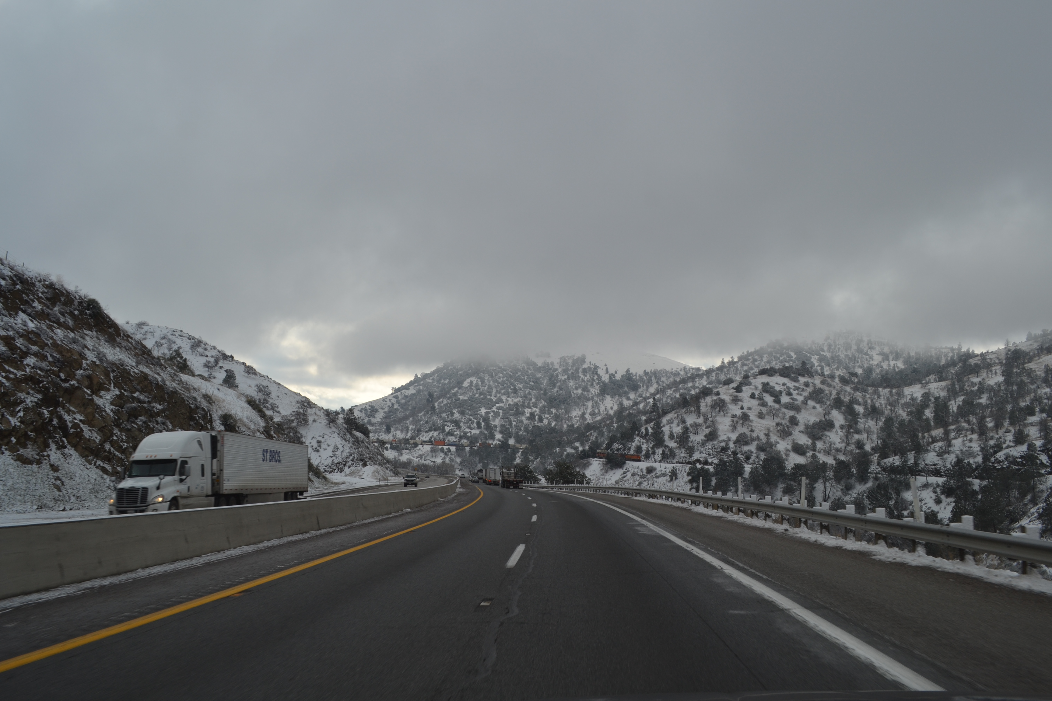
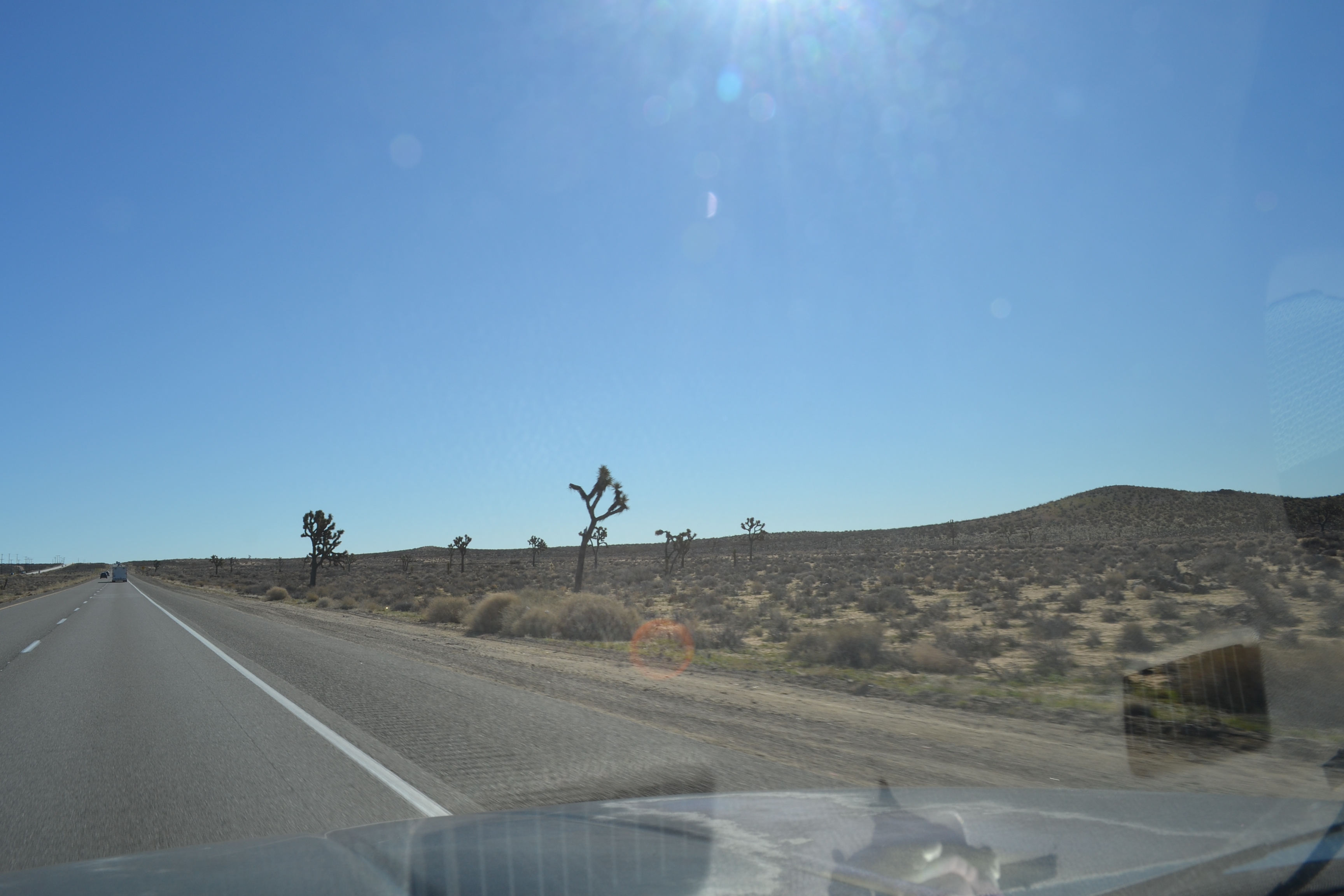
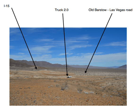
This place reminds me of Radiator Springs! I was wondering around and met Paco. Paco has been here for 20 years now. He drives the local tow truck (yup, Mater). He told me the place was founded in 1924 by a family who ran it until 1980. Back then there was no I-15. Highway 93 (maybe) was the route from Barstow to Vegas and it was a bit more bendy and followed the curves in the desert. Paco said back then there were gas and repair stations about every twenty miles. He said that was because twenty miles was as far as a car could go before needing repairs.

Not to scale
Looking up runway toward the gas station

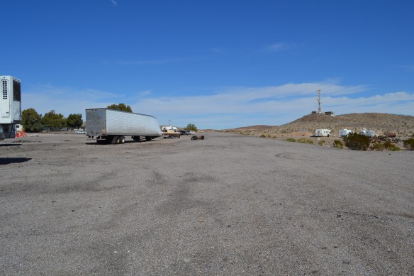
Now there are three families living and working at the Beacon Station Shell gas store. The current owner also has a plane which occasionally lands here. There use to be two runways, but now it looks like only about half of one runway is still useful. They got a water well when the new owners took over, before that they hauled water in.

Looking down runway at the useful part

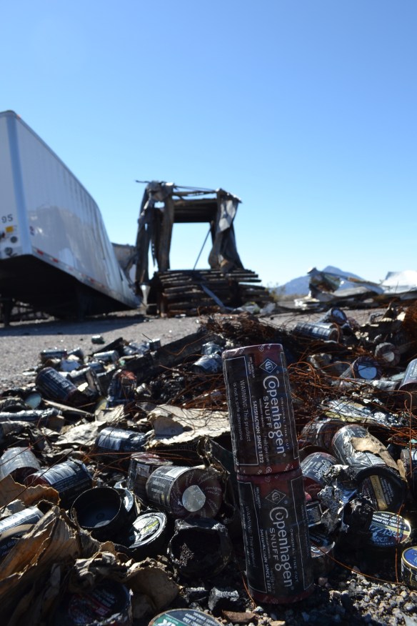
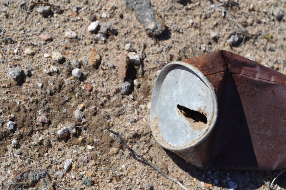
A walk around the desert was a trip back in trash-time. There are cans strewn about the desert many of which are oil cans from a time when oil came in cans. There are drink cans which were opened with a church-key, drinks opened with removable pull tabs, and modern cans too. Some of the vintage cans are all-steel, while other have an aluminum top. The aluminum top lasts way longer than the steel can.

The wind-sock has seen happier days

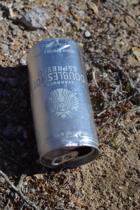
It’s amazing how long trash lasts. I hope a hundred years from now people will be as interested in old starbucks cans as we are in old oil cans. On the other hand diapers from 1930 decomposed long ago. Not so diapers from the 21st century.

It snowed two nights ago. Now the grass is growing so fast you can see the difference from morning to noon
Smokeless tobacco is known to the state of California to burn semi-trucks to the ground
All the brown spots are piles of old oil cans
Drink can on the left, Oil can on the right, floating in a sea of beer-bottle glass. Multi-media circa 1940
Old-style drink can opened with a church-key
Steel can with aluminum top. Old pull-tab style
Modern aluminum can with captive pop-top. Thanks Starbucks!

Bakersfield to Rasor Road


Still in California
We left About 8:30 and headed up the hill towards Mojave. It started out green, turned to white, and then transitioned to brown. We stopped for lunch at the rest area near the Borax factory. We could see the planes flying from Edwards AFB – Zoom! I was going to visit the Flight Test Museum, but it’s off limits to muggles (It’s on-base and behind many gates and guards)

Over the hills to Mojave
Much drier now. Still cold, but it’s a dry cold

After we got back on the road a B-1 Bomber buzzed us! I heard it long before I saw it and it was loud!

This was our 5th day in a row on the road so Plan A is to spend a couple nights here in the desert south of Vegas. I picked a spot where the boys can go outside and play with rocks if they want to

Who let the boys out?

There is good solar access here; no trees to block the juice-making photons!

You Can Check Out


But you can never leave!

I’m trapped!

The State of California is beginning to seem a lot like the song. I tried to leave going to Reno but no. I’m trying to leave by going south, but that is also problematic! This morning CA 58 was closed due to snow, I-5 is closed (ish) due to snow, I-15 is closed because of an over-turned semi-truck. I just want to go where it’s dry and gas is cheap! Is that too much to ask?

If not getting to go to Reno was gods way of saving me from something, and if this is better than I-80 then wow! Just wow. This path out of the state was been a pain in the tucus so the northern route might have been super-no-good-bad-to-the-bone

Have no idea what these are besides lovely

On the plus side I got to see some tree blooms and hear some birds sing
.
.
.

Donner Pass = Fail

Too much snow!

We made an attempt to climb over the mountains before the storm. Started out at 05:00 and ran into the snow around 06:00. Ran into chain laws around 07:00 and since I don’t have chains for the trailer Cal-trans said no go Reno

Since I was apprehensive about the northern route I decided it was a message from god and we turned around and headed back west and then south at Sacramento. Adds a couple days to the trip and I’ll miss driving on america’s loneliest highway, but I get to see Barstow and Vegas – YaY!

We also scored another entry in our worst roads list: Hwy 99 through Merced CA is another concrete shit-storm. Thanks again Cal-trans. My experience with Hwy 99 is mostly a continuous ribbon of traffic passing a nearly endless supply of commercial and residential development. Just north of Fresno we started seeing fruit trees in bloom. That was nice
.
.
.

East-bound and down

Leaving Cotati and my great hosts Jim & David.

Fridge with food courtesy of David’s cooking skills

After more than a month hanging out near the coast and the big trees it’s time to head east to Fruita, mtn biking, and camp hosting for the summer. The boys are going to miss stalking gophers and playing with baby potatoes in Jim & David’s garden!

The trip from Cotati to Loomis is a back-track for us. We planned an o-dark-hundred assault on Donner Pass to beat an incoming snow storm and our base-camp-one was Loomis, CA

.

.


Cotati to Still Water Cove

It’s a vineyard! The little sticks are the tops of the vine supports

A little coastal flooding did not keep us from driving up the Pacific Coast Farm Road (They say PCH, but it’s a farm road!) to Still Water Cove where the water was anything but still. A big storm blew inland the day before we headed out to the coast. The forecast was for perfect weather the day we were planning to leave so we brought lots of firewood and food!

Our weekend home

The Russian River was above flood stage as we drove along side it toward Jenner and many of the vineyards were under water (literally, not financially). As we wound our way up the PCH (farm road) we passed a few land slides and downed trees

tMy camp site #9

The camp ground was very green and mushy. It’s about 200 feet above the ocean and I was wondering if a tsunami could sweep it away. There is easy access from the campground to the beach and also a bluff overlooking the ocean. I spent a fair amount of time on the beach or the bluff enjoying the crashing surf

After more than an hour of climbing I found a bridge that was not washed out

I did some hiking up the canyon from the campground and managed to hoof it up to where the sun was shining. Next day a group of us hiked over the river on some downed trees and up to the old school house.

It got cold enough to hail on Saturday
Hanging around the camp fire while David dances the canopy up
A meditation spot along the PCH
Didn’t see this until I was done with my morning swim
Still Water Cove
Pam and Jimmy bravely cross the fallen tree
More natural bridges
Can you see me now?

Winter is coming for me!

The hills east of Cotati, CA

I barely escaped being snowed on here in warm and sunny* California! The snow level came down to about 400 feet! Eeek! Next morning there was frost on the pumpkin! Eeek!

Over the weekend we had a camp-out in the back yard. I remember doing that as a kid. Pitching a tent on the back lawn and sleeping under the stars – good times! As an adult we circled the RV’s around the garage, built a fire in the driveway and hung out in the garage when it was raining and around the fire when it was not.

Jimmy and Sandy enjoying the camp fire

Some family members camped out with us while others came and went as the beer-tide ebbed and flowed

.

.

*It’s cloudy about half the time

Weather Watch

From NPR.org
(link below)

Like everyone who has gone before me I’m going to talk about the weather, but not do anything to make it better.

When I started my little journey I imagined I’d be able to follow the perfect temperature north and south as the seasons progressed. North in the summer, south in the winter. Always 70ºF with the perfect amount of shade and always just a bit after lunch.

In fact I’ve been super glad to have bought a 4-season coach because it’s been real cold many times. We started this adventure last February when the temps were hovering around zero degrees F (Colorado). We sat through a month of temps over 100ºF in Montana (and Canada!) and traveled across Wyoming when it was -2ºF. Being able to follow the perfect weather has proven to be like catching rainbows – can’t be done! If you are one of the people who is happy where you are then revel in that! Stay put!

Now it’s February again and we’re in Northern California where the overnight low is between 34º and 50º – Highs between 50º and 70º. I can drive to the beach or the redwoods in about an hour which is kewl. Food and fuel are more expensive here than Colorado, but the car drivers are a lot more polite than they are in Denver. And I do mean car-drivers. There are fewer pick-up trucks here and lots of electric and/or hybrid cars. Big shout-out to my friends Jim & David who have a house here with a super big yard. It is through their kindness I am enjoying the good life near the beach! (plus the boys have a yard! YaY!)

I wondered what -50ºF was like so I put 6 of these in my mouth at the same time. Bad idea

Last week (end of January 2019) was when temperatures in the upper-mid-west plunged below -50º F and I’m happy not to have been there! I’m sure my 4-season coach would be frozen solid in -50ºF. You can read about it on NPR in case you need a reminder

Today (01Feb2019) a big wet-kiss of a storm is making landfall in this area. Coastal flooding, torrential rains, etc. Tomorrow the frogs will be very happy!

And besides, we need the moisture!

.

.

Here is the link to NPR: (https://www.npr.org/2019/01/31/690399029/polar-vortexs-end-is-near-forecasters-say-promising-a-strong-warm-up)

Big Trees!

We went to Armstrong Forest a few days ago and looked at the very tall trees. The one named Colonel Armstrong is 308 feet tall and 1400 years old. It was a sapling in the year 600 AD. I took a bunch of pictures and there is no substitute for being there staring up at someone you cannot see the top of. Their trunks are so massive they create their own gravity well that sucks you right in to touch and hug them. 

Once I stepped back a couple hundred feet I could see the top of the Colonel in the sunshine
They get a lot of rain around here. I think this used to be a drinking fountain
Dappled sunshine touches the ground

Trip to the beach day

Day One

I totally spaced taking a picture of the ocean so here is a picture of kitty in his happy place

We took a drive from Cotati to Bodega Bay & Bodega Head to see the big water. It was a delightful no-rain day. The waves were fairly big and crashing into the rocks so I really enjoyed that.

We also stopped at a different spot on the beach where the under-toad was very strong! There is a big sign warning beach-goers of the danger. Apparently the surf can kick your legs out from under you and drag you far out to sea where only sea lions dare to go.

After the beach we stopped for fish and chips at a great local restaurant. I saved part of the fish for the boys 🙂

Day Two

Remembered to take a pic this time

Spent the day at friends house on a cliff overlooking the ocean. The hawks were soaring and the deer were browsing while the wind blew rain against the windows. It was lovely even though we were too far from the ocean to walk down and touch it.

.

.

.